Comprehensive Plan and Map

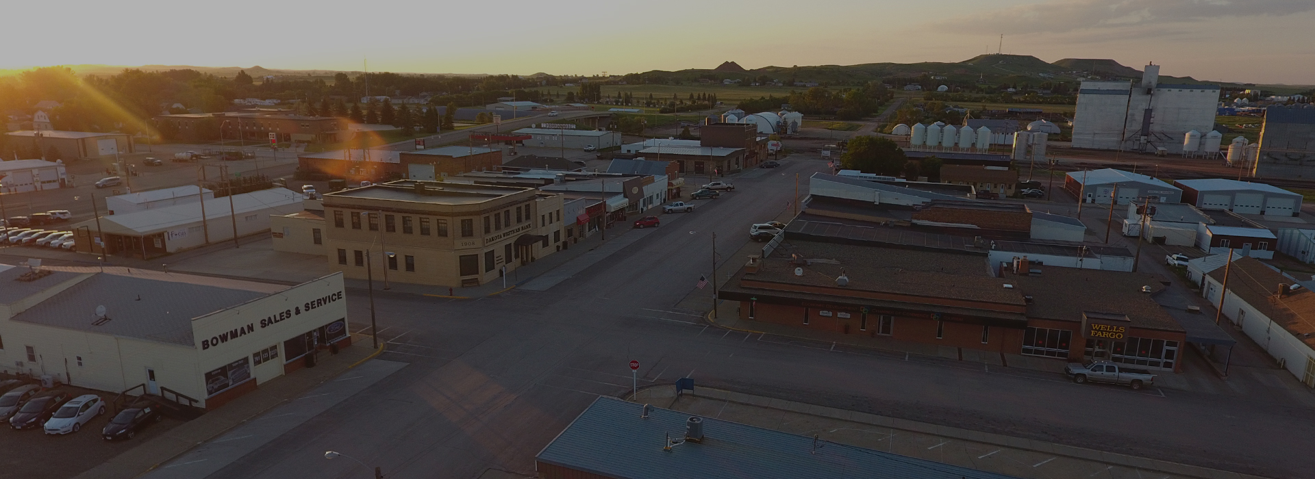
Comprehensive Plan Map

Comprehensive Plan- Future Land Use Map


The future land use map consists of two components: 1) a map that identifies the City’s land use designations; and 2) a legend that describes the intent of each designation.  The purpose of the land use map is to serve as a basis for the City’s zoning decisions, thereby fulfilling a requirement of the North Dakota Century Code (NDCC) to plan for future growth.  The map supplements the City’s Comprehensive Plan document by providing information about the city’s intent to both developer’s and property owners.

Comprehensive Plan


The purpose of a Comprehensive Plan is to establish a reliable source of information about future development and to serve as a basis for both land use amendments and zoning code amendments.  Amendments to the Comprehensive Plan and the zoning code require a public hearing process that includes review by both the Planning and Zoning Commission and the City Commission.  This procedure is established in the plan.  Each chapter of the Comprehensive Plan is listed below and can be accessed by clicking on the chapter name:


Table of Contents

Introduction 

How to Use the Plan

Community Overview 

Community Overview Section 2

Planning Process

Community Vision, Goals, and Objectives

The Plan

Comprehensive Plan Implementation

Contact

CONTACT

PHONE:
City Hall (701) 523-3309
FAX: (701) 523-5716

101 1st ST NE
PO Box 12
Bowman, ND 58623

OFFICE HOURS

Monday – Thursday:
7:30am – 12:00pm MT
12:30pm – 4:30pm MT
Friday:
7:30am – 12:00pm MT
(Closed on Legal Holidays)